Tuesday, 16 August 2011

Collaborations

I was talking to Shelley about undertaking this mapping process together. The scope of the project could potentially become quite large and the 3d map installation could also be a big undertaking. We got talking about the texts she had read and how they have relevance. She also could identify with this topic and could see the data collected being presented in a hanging installation to represent the ephermal quality that memories have.

This could be a interesting direction. Perhaps the hanging installation could reveal particular places/memories from different viewpoints.

This discussion reminded me of an artist, Claire Morgan, that I have admired over the years and the beautiful moments she captures in her work:


Seminar Mapping

So from the reading I'm quite interested in the idea of the stories/memories of a place that come about by its telling and it is these personal relationships that give places a particular significance. People make a place. 

Auckland can be characterized in many ways with water. It is predominately surrounded by water and it is an area uniquely situated in between two main bodies of water:  Manukau Harbour on the Tasman Sea and the Waitemata Harbour on the Pacific Ocean.
Cities are nothing without people, and Auckland would not be Auckland without its waters. I want to find out the relationships the city has with its people through its key/defining element of water. I want to map physical bodies of water in Auckland that people identify/encounter/associate with by collecting a selection of stories/memories revealed about different places.

Methodology:
I want to collect data by asking fellow Aucklanders to list places say five* physical bodies in Auckland and why. This might be an informal discussion with people in person, using social media or via a survey. I hope to find reasons that invoke a particular memory, significance or reputation, and if they have been there. The number of places asked for may vary depending on initial findings. *(Subject to change: The more places required increases the likeliness of naming a place purely for reputational reasons)
This research gives situational data as well as personal/intangible data that could encompass a number of different categories for how Aucklanders might identify themselves with a place; culturally, social, spiritually.
Test example: I asked my mum to 'name 6 bodies of water in Auckland and why did she named those places.'
1) Jellicoe Park fountain-  Where Jane(her sister) had her first house.
2) Mission Bay fountain - Where her sisters and her always went to when they were little.
3) Albert Park fountain - City place to rest and where she would go when she would sometimes pick me up from uni.
4) Buckland's Beach - Where Cindy (her sister) lives and where we would sometimes have big family gatherings.
5) Devonport - famous place for its beautiful sunset and view of Auckland Central City.
6) Museum fountain - Where she took her wedding photos.
Forms of representation that you might employ in making the mapping:
At the moment I'm quite keen on creating a 3D map or an installation of some kind.
Example: Map Installation - Melbourne Museum - 2007
The array of columns that greet the visitor to the Melbourne Museum are manufactured from specially punched and folded perforated aluminium and 6mm thick aluminium flanges. The columns are finished with automotive paint which have been mounted permanently on heavy steel plinths that are able to be moved by forklift to create space in the Museum Foyer when needed for private functions.
Inside each column is a range of acrylic formed display boxes that house samples of site specific goods from various parts of Victoria. This installation job presented it's own challenges owing to the size and weight of the objects that needed to be moved on an occasional basis. When the viewer stands in a specific place in the entrance foyer, perspective joins all of the columns up to create a map of Victoria.
I like how the map is revealed from a certain perspective. Like a place is revealed from a person's own memories.

Janice Caswell

I was researching how one might map memories because I'm quite interested in how you could map something so intangible and ephemeral. Janice Caswell has an interesting methods of mapping memories.

She says her work arises out of a desire to capture experience and an impulse to locate, arrange and secure the past. Her work also embraces the mind’s faulty processes in trying to accomplish this. She creates her mental maps in the form of large scale wall drawings and works on paper. She connects a system of color coded circular points with drawn lines or threads to define a space and re-create a past experience using an organizational map constructed from her own memories. She admits that there is no way for her to accurately chart these memories, but she is more interested in the process of how the mind organizes information and how that can play out visually. When you look at her work you get a sense of how memories can be so intertwined, that making them fixed points on a timeline could be impossible to sort out.


Monday, 15 August 2011

Cities and Memory

Something that has lingered from our class discussions and readings is an excerpt we read from Invisible Cities: 'The city consists of relationships between the measurements of its space and the events of the past... As this wave from memories flows in, the city soaks it up like a sponge and expands.... The city, however, does not tell its past, but contains it like the lines of a hand.'  

The story of a place/event that comes about by its telling and which in somecases precede or overshadow a place. Connections that can exist even through a foreigner, for example knowing the stories through the media. This can give an really finely tuned sense and perception of what a place might be.  
eg The nuclear bomb on Hiroshima, or the bakery from Sex and the City in New York.

Magnolia Bakery in Manhattan, New York


Could be an area worth investigating for mapping?? The stories that might precede a place of water.

Friday, 5 August 2011

Wynard Quarter


Today, Auckland's Wynard Quarter just opened. An important transformation of Auckland's waterfront just in time for the Rugby World Cup.


Len Brown, Supercity Mayor, "Auckland's most significant connection is with its water's edge, and at last we have a natural physical link."


Video Link of Opening: http://www.stuff.co.nz/auckland/5399720/Wynyard-Quarter-opens-today


Animation of Wynards Quarter
http://www.waterfrontauckland.co.nz/Areas/Wynyard-Quarter/Image-Gallery/Animations.aspx:

Queen Street - The Waihorotiu Stream

I've heard many references and stories about how Queen Street used to be an old stream. The tiles on Queen St are oftened reminders of this stream. So I decided to find out a bit more about it...


The Waihorutiu Stream (or sometimes Wai Horotiu Stream) also refered to as the 'Queen Street River', is a former stream in the downtown region of Auckland City, New Zealand, which has long since been covered over and made to disappear by the increasing urbanisation of the area. Originally, it was an open strem starting out in a gully before flowing through a swampy area and then down the centre of what was to become Queen St.Water percolating through the soil under Myers Park still runs into the old sewers under Queen Street to the sea, discharging under the Ferry Building.


Myers Park, Auckland


Video : http://www.qwiki.com/q/#!/Waihorotiu_Stream  

HISTORY: 


[When Hobson, the Lieutenant Governor of New Zealand, visited the Waitemata, what is now Queen Street valley was nothing more than a fern covered swamp. But it was a swamp that Hobson saw potential in - describing the harbour as being the "best harbour on the whole of the western coast of New Zealand," and he chose Auckland as the site for the country's capital


The Wai Horotiu was the original stream that drained the Queen Street valley. It was channelled and named the Ligar Canal before it was culverted beneath the pavements. As a reference to this once-pristine stream, white tile motifs will be placed in the new basalt paving to denote the whitebait that once made the creek their home.]


http://www.aucklandcity.govt.nz/council/projects/cbdproject/queensthistory.asp


The Waihorotiu Stream - now channeled into brick sewers underneath Queen Street done in the 19th C.


Aotea Square was originally the location of a swamp fed and drained by the Waihorotiu Stream. The stream was turned into an open sewer canal and eventually bricked over and the swampy area drained. A three-story underground parking garage accessible from Mayoral Drive and Greys Avenue was constructed in the 1970s.


The sculpture that has remained in Aotea even after its renovation includes Hone Tuwhare's (1922-2008) haiku which was changed slightly when used in an Auckland City Council sculpture project on the footpath just up from the Civic Theatre, to celebrate the (now) hidden Wai Horotiu, Queen Street's stream turned into brick-lined sewer in the 19th century. (http://timespanner.blogspot.com/2010/10/adding-colour-to-auckland-gateway.html)


 In Maori mythology, the stream is the home of Horotiu, a local Taniwha (roughly speaking, a local nature spirit).

Rain Forest Express

I never knew about this, could be something to check out, although it looks to be aimed at the younger generations. Visual experience of where Auckland's water comes from... 

Its been going since 1998 and receives 12,000 visitors a year. It offers a unique and upclose experience through the Waitakere Ranges. You travel into the Waitakere Catchment area and experience of :
  •   Ten pipeline tunnels and nine bridges, including the dramatic Quinn’s Viaduct
  •   The historic and tranquil Upper Nihotupu dam - a working water supply dam
  •   Personalised commentary on local history, flora and fauna
  •   Close-up views of glow-worms and cave wetas
  •   Scenic picnic spot with tables and barbecue

View to the Manukau Harbour

The bridge and pipeline


During the journey your train driver will tell the story of the Rain Forest Express from its role in building the dams which now help to sustain Auckland, through to its use today. After visiting the dam, take a stroll to Seaver's Camp, overlooking the Nihotupu Valley and Manukau Harbour. The train will collect you from the Camp for the return journey.

AQUA


One drops that are held by visitors that enable interaction with the screen

 The 360 interactive screen

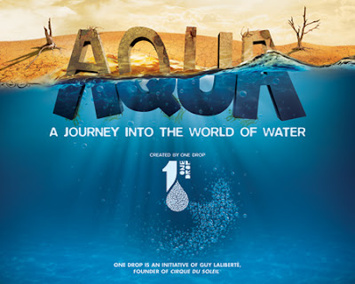
I recently went to the interactive exhibition currently showing at the Auckland Museum called AQUA. It was a 30-min experience that involved the use of a 360° projection, interactive digital screens, music and visual effects to  tell the story of water. It was a collaborative project between ONE DROP and Cirque Du Soleil. The primary aim was to raise an awareness about the importance of water and encourage action to preserve this vital resource one drop at a time.

http://www.youtube.com/watch?feature=player_embedded&v=zj-qjF6uEhU#at=26